15. Juni 2015
Across the Alps by Bike
 A journey through valleys, villages and across mountain passes, through sunshine, rain, and thunderstorm: in this year’s mountain bike trip, we crossed the Alps from Oberstdorf in Germany to Lake Garda in Italy.
Day One: Oberstdorf – St. Anton
The first day. It’s raining. No, it’s pouring down. Thunder accompanies us on our way to München Hauptbahnhof, where our train leaves. Our shoes are already completely soaked by the time we arrive at the railway station. But during rush hour, it is not permitted to take bikes on the Munich underground or local railway services. At the early hour and in the rain, it is no wonder that we are almost the only cyclists on the road. Unfortunately, the weather forecast predicts rain and the occasional thunderstorm also for the next days.
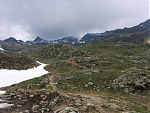
When the train arrives in Oberstdorf – a town in south-western Bavaria on the border of the Alps – the rainfall stops and we are even getting a glimpse of the sun. After checking out the local weather conditions and some last-minute shopping for spare parts, my friend and I embark on the first stage of what we planned to become a six-day trip to Lake Garda in the north of Italy. Equipped with the GPS track and map coverage of the route Alta Via Claudia (as described in Achim Zahn’s book ‘Alpencross Ostalpen’), we pedal up towards the first mountain pass (Schrofenpass) of our trip. Fortunately, the weather conditions remain reasonably favourable (otherwise we would need to turn back). The last section of the trail to the mountain pass forces us to push and carry our bikes, and to tread carefully.
(Photo courtesy: M)
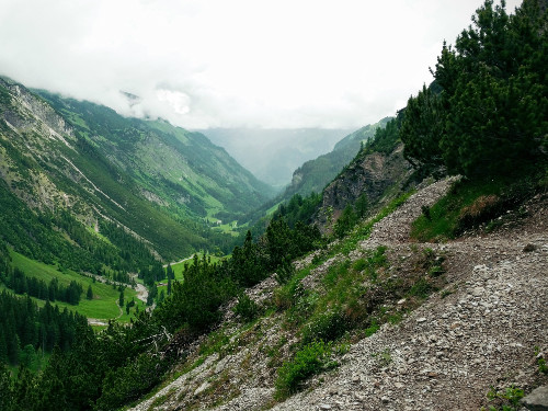
On the other side of the mountain pass, already in Austria, the clouds are hanging low and greet us with a good portion of rain. The joy of riding the MTBs down the mountain (the lower parts are no problem despite of the rain) and along the pretty route on the 198 from Warth to Lech is short in nature. Up it goes to more mountain passes (Flexenpass, Arlberg). These small humps on the elevation profile look very innocent, but only on paper. The uphill journey continues. At this opportunity I also learn how convenient it is to have the rear lights always mounted; there are a few short tunnels and long avalanche galleries along the way.
(Photo courtesy: M)
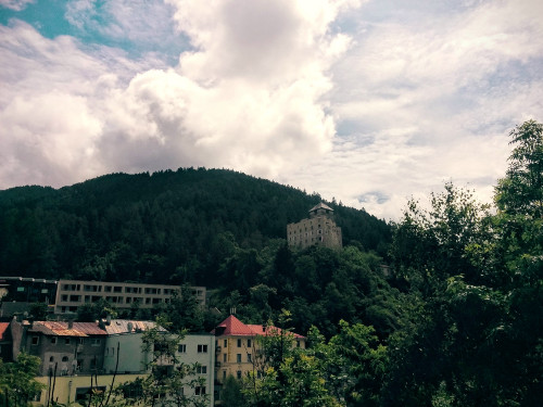
The villages along the road are geared towards winter tourism. In the beginning of June, these villages look eerily abandoned. Our final destination on the first day is St. Anton. The winter season is over, and the summer season has not begun yet. Most of the places to stay are closed.
Day Two: St. Anton – Glurns
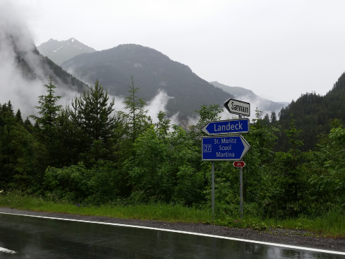
On the evening before day two, staff at Hotel Falch inform us that Paznaun has become a disaster zone after heavy rainfall and subsequent landslides broke havoc in some of the villages in the valley. They recommend us to take a detour and avoid the valley completely. We agree and change our plans, deviating from the original route. This is a bit sad because it means we will no longer be able to cycle through interesting mountain ranges to Samnaun in Switzerland. But it makes no sense to take unnecessary risks, so we cycle down towards Landeck.
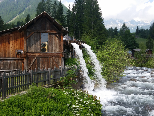
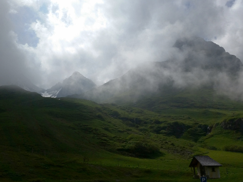
Clearly, the water level in streams and rivers is above average. The first section of the bicycle path from Landeck towards Reschenpass is closed, so we’re forced to share the road with the cars for a while. There is ongoing construction, and we are lucky. With our bikes, we can skip past the traffic jam. In stark contrast to day one where we were basically the only cyclists, we meet more and more people in this area.
(Photo courtesy: M)
Waking up late and having late lunch is not always advisable. It turns out that some kitchens close “early”, and after two o’clock we need to pedal on for a while until finding a guesthouse. Promptly, it starts raining and fellow bicyclists in the restaurant decide to call it a day. However, after an extensive meal, we put on our rain gear again and continue towards Engadin in Switzerland. Through an uninhabitated stretches on a relatively empty road, where low-hanging clouds in the deep valley create a mystical atmosphere, we reach Martina. There we cross the Swiss-Austrian border again and tackle the 500 m ascent to Reschenpass. In Italy! When crossing the Alps from north to south, this effectively means that it is going down most of the time from now on. Originally, we would have reached Italy on day three if it were not to the “detour” via Landeck (which was actually more of a cut-off in this regard). On the excellent bicycle paths of South Tyrol, we speed downwards towards Glurns.
Day Three: Glurns – Ulten
Once in Italy, it only goes downhill. Wrong! This is only mostly true when choosing to do so. We follow the suggestion from the book and after cycling for a few dozen kilometers, we leave the valley and climb up to Naturnser Alm. A small road with panoramic views but also monotonous stretches climbs up for about 900 m in a single go. Sadly, having reached the small cottage at the top, there is no time for having a well-deserved drink and bite. Instead, we need to make some more progress and roll down the other side of the mountain. We paid so dearly and now all of the elevation is lost in so little time. Worse is that we actually have to climb up again for the last few kilometers.
The GPS track turns out to be very useful and time-saving when it comes to detailed navigation, particularly when going downhill. No need to remove the map from its case all the time to check where we are and where we need to go. Still, the map provides good value and we use it for ad-hoc planning and deviations from the saved GPS track, and also for coarse planning on the day before.
Day Four: Ulten – Cles
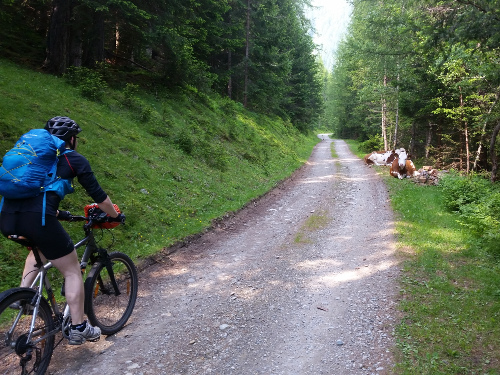
This stage is a highlight. After yet another extensive breakfast, we start cycling towards Rabbijoch. This mountain pass at 2449 m will be the highest point of the whole trip. On a sunny day we start a long climb up a long valley. The cows apparently enjoy standing in our way. A few hikers we meet along the way experience the same. Anyway, our main concern is to make some progress on the ascent. This time, we hit the road earlier and can spend some time at Kirchbergalm, which fortunately opened for the season on the day before. Serendipity!
On the way up to the pass, there are no hikers anywhere. But four other mountain bikers slowly and steadily follow us. One of the bikers comments on my old-school, hardtail mountain bike: “Ambitioniert [Ambitious]”. Over the years, my low-budget but rock-solid mountain bike has become an odd sight among the standard fully-suspended bikes. Indeed, on my hardtail bike I feel every stone that is hardly noticeable with a state-of-the-art fully-suspended mountain bike. Nevertheless, the bike is in very decent shape, well-tested, and good enough for a good part of the trails before we hit wider paths and roads. After all, the bicycle has served multiple purposes in its lifetime: city bike, touring bike, commuter bike & room decoration.

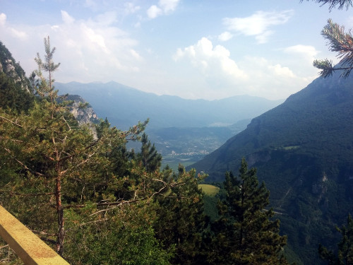
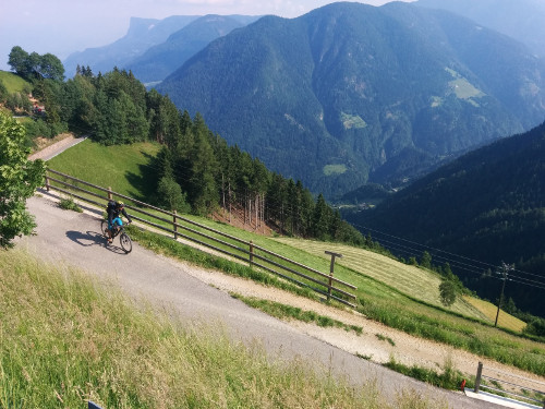
The panorama from the top and on the way down from Rabbijoch is excellent. We can see Etschtal and the Sarntal mountains. A few pretty houses and meadows decorate the mountain flank. This, and the very long descent are reward for our prior uphill efforts.
When we arrive in Cles, I get reminded that crossing the Alps by bike is a popular activity. Groups of mountain bikers cross the alps with a shuttle service carrying huge amounts of luggage from accommodation to accommodation. I wouldn’t be able to remove much from my backpack anyway – it is more a daypack forced to last a week long. But having a completely fresh set of clothes to put on in the evening has a certain appeal. Yet, you have to pay extra, it is less minimalistic, and you probably lose a bit of flexibility as well. With having the clothes washed in the middle of the week, and having good materials (Merino wool lives up to its promise) I would carry my stuff again on a similar future trip.
Day Five: Cles – Lake Garda
My legs definitely have to pay the toll for the elevation gains and the long distances from the previous days. The day starts rather easy with a ride on the road through endless apple orchards and a few pretty villages. For example, we cycle on a small road through orchards to Maurina, where the road turns into an archway. We follow a bike path on the flank of the Brenta Dolomites. There is nobody else. After the descent to Lake Molveno, we learn again how difficult it is to find some place for late lunch.

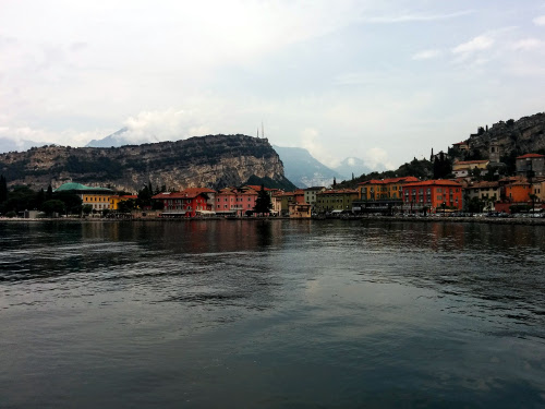
The last major ascent awaits us. Then, after coming down from the mountain village Ranzo, the temperature increases noticeably. Finally, after more than 400 km in total, and an estimated cumulative elevation gain of 8500 m, we arrive at our destination, Lake Garda.
Return
A bicycle path leads us from Torbole at Lake Garda to Rovereto, where we expect a Eurocity train to take us directly to Munich. Unfortunately, buying tickets for a bicycle is quite complicated, and there is no space for any more bicycles on the particular train. The lesson here is to plan and buy tickets at least a day in advance. As far as I can tell from staff’s comments, the problems with bicycles occur every weekend, so we are left wondering why the don’t just add an extra carriage for bicycles. Ultimately, we make our way to Brennerpass, where we take advantage of the elevation profile and make the 40 km to Innsbruck in less than 1.5 h. Who thought we would use the bicycles also to get back? In Innsbruck, we take a long distance coach to Munich. The coach has a bike rack installed on this particular route. We’re lucky, there are spaces for us and our bikes left. I wished buying a ticket for an international train service for both oneself and one’s bicycle would be as easy and hassle-free.